Humans have interacted with the planet in a number of bizarre ways, and the national border is definitely one of them.
The human race has come up with some odd ideas over the millennia, and national borders are one of them. Sometime during the early Renaissance, rulers essentially decided that the best way to strengthen the state and preserve its wealth was to define it spatially, carving up chunks of land into blocks of varying sizes, where everything from the rules of the road to which government officials are allowed to shoot you changes the second you cross an imaginary line. Many national frontiers hew close to natural boundaries, such as mountains and rivers, but in places where nature doesn’t oblige, it often becomes necessary to express these divides by building the barriers ourselves.
This act isn’t a small undertaking. Some of their scars can be seen from space, and they’ll probably call for a lot of explaining when the aliens do finally arrive to conquer us:
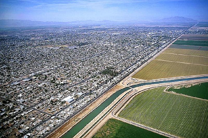
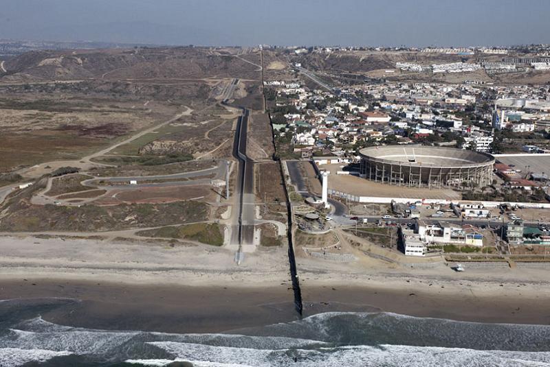
Mexico-California
The US/Mexico border is just about the only place in the world where a First World country sits across an arbitrary frontier from the Third World. This shows clearly in almost every picture of the border zone, as subsidized irrigation and high property values are par for the course in California, while Mexican communities get by as they always have, mainly neglected by their central government.Aerial Photography - Airphoto
The United States is generally serious about policing this border, though it's amusing to think that the necessary enthusiasm for tight security kind of peters out a few hundred feet from the beach. It's likely there's still vigorous enforcement beyond the reach of the fence, but something tells us you could stretch the fence to Australia and determined people will still get around it.American Patrol Report
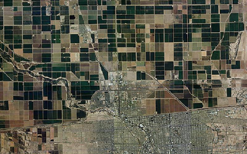
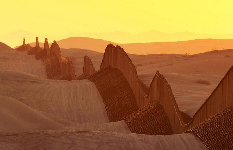
Mexico-Texas
El Paso is a reasonable-sized Texas city of 700,000 people. The city is mashed up against Juarez, Mexico, which is twice as large, much less prosperous, and fueled partly by catering to every sin El Paso residents can think to commit there.Snipview
Nearly as good as the Great Wall of China, basically as effective, probably more expensive.The Atlantic
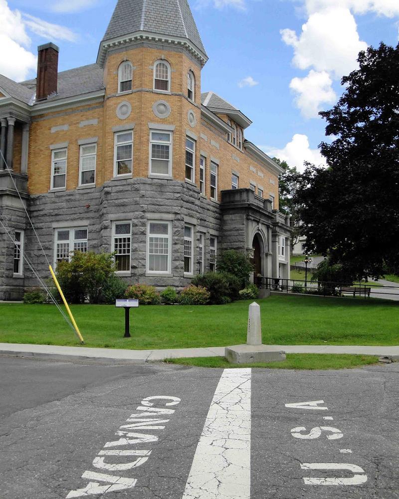
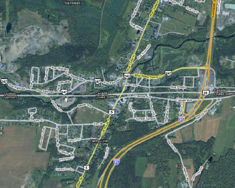
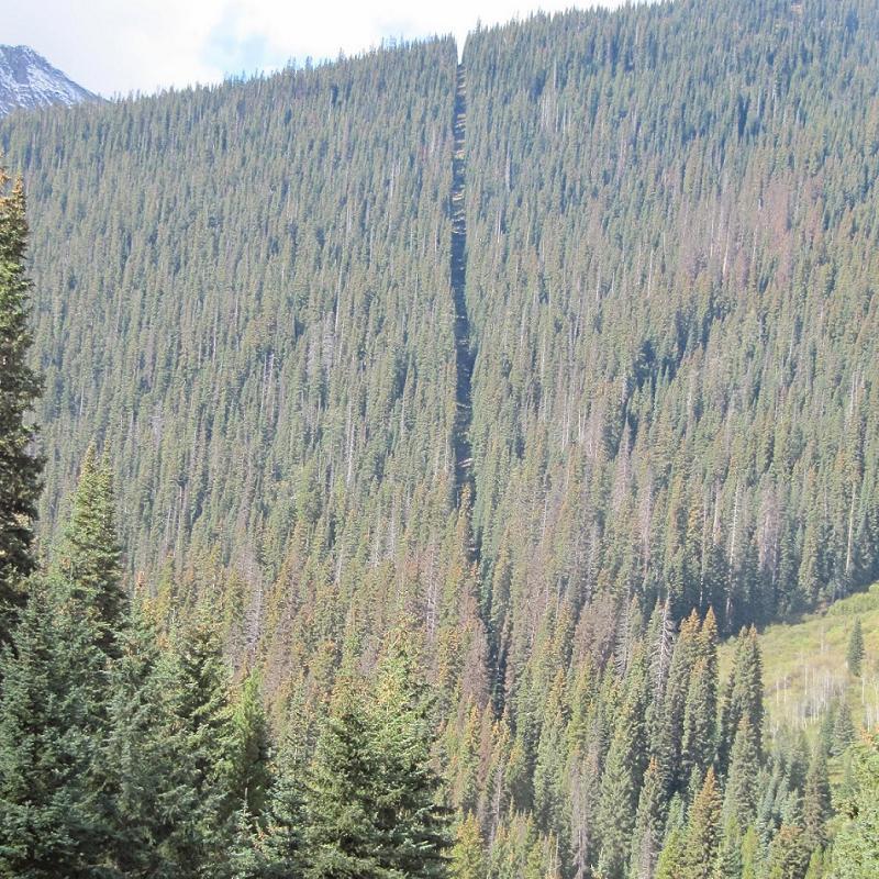
Canada-United States
On the other end of the United States sits the town of Derby, Vermont. That is, unless you're Canadian—then it's Rock Island, Quebec. This town was founded before the American Revolution, and the so-called "Derby Line" cuts straight across it. For 200 years, neighbors on either side of this line were at liberty to stroll into each other's countries. In the general paranoia that settled over us all after 9/11, however, passport control was instituted even here. The building in this picture is the town library. You can enter from either side, but it's a crime to leave by the opposite door without getting your passport stamped. Geographically Yours
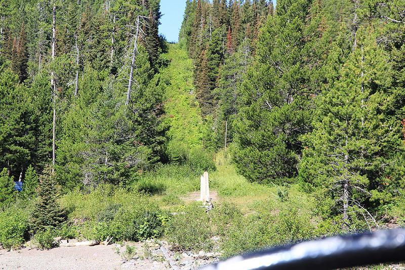
This is what thousands of miles of US/Canadian border looks like. Since so much of this area is completely open woodland, the need was apparently felt to pass an electric razor worthy of Shiva over the landscape, just in case some of those trees start getting ideas.Universitetet i Bergen
The swathe is serious business. It continues the majority of the border's length, and is regularly trimmed.Rabbit Stick Chronicles
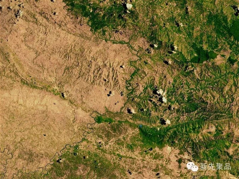
Haiti-Dominican Republic
Speaking of trimming trees, this is the border between Haiti and the Dominican Republic. The Dominican Republic isn't exactly Qatar for personal wealth, but Haiti is the poorest country in the Americas. Quite a lot of Haiti's energy comes just from burning wood in campfires. Haitians trim the branches off trees for fuel, keeping the trees alive as long as possible, then come back for the main trunk. Decades of this have left what was once a rainforest almost wholly denuded. Dominican border agents patrol the line to keep timber poachers away from the trees that are left within walking distance of the Haitian frontier.YOKA
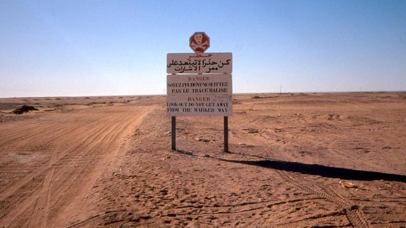
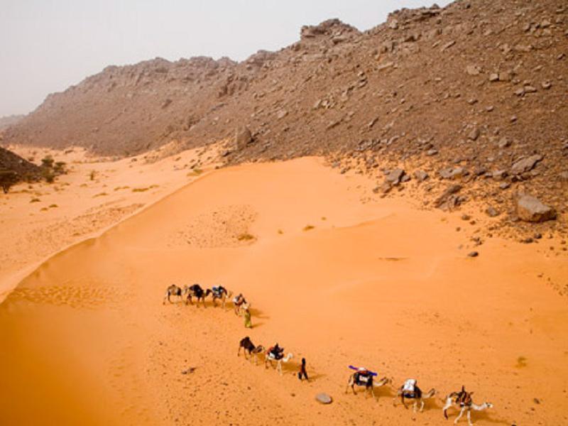
Algeria-Niger-Mali
On the border of Algeria, Niger and Mali lies the Tanezrouft basin...and practically nothing else. This formation has the distinction of being one of the driest and least hospitable parts of the whole Sahara, and practically nobody lives here. Wikipedia
Almost the only "populations" of the area are transient caravans of Tuareg nomads who will die if they respect national boundaries between themselves and the nearest water source. Naturally, the area is heavily mined. Globe Tourism
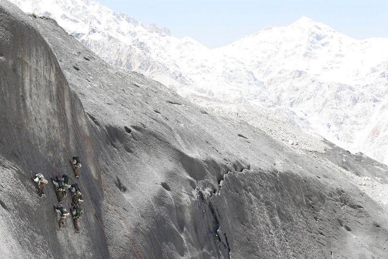
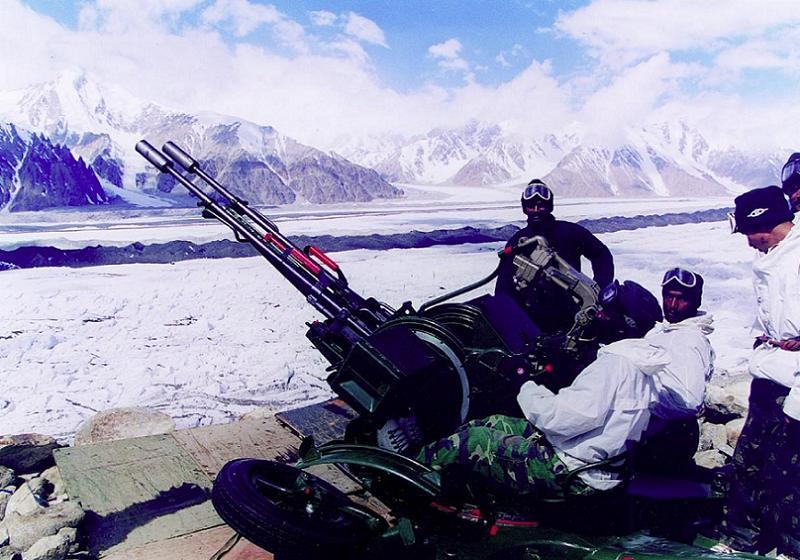
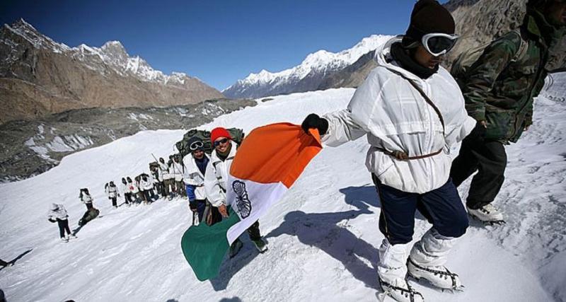
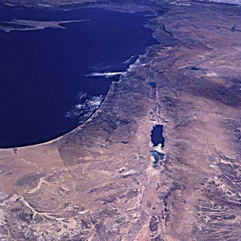
India-Pakistan
Some borders are contentious, usually for silly reasons. Since India established a military presence in the glacier in 1984, Siachen has been known as "the highest battleground on Earth." Pakistan also claims the region, and has established a permanent military presence thousands of feet in the sky. Army Photos
The whole border area is subject to pointless violence, as both countries appeal to a little ambiguous wording in the 1947 partition agreement to argue that they, and they alone, should rule the totally uninhabited glacier, which sits almost 19,000 feet in the air. India is in physical possession of most of the glacier, but Pakistan isn't above the occasional artillery exchange. Fun Fact: The air is so thin in Siachen, the ballistics tables of artillery shells have to be recomputed because of reduced wind resistance.The Consortium of Indian Military and Defence Websites
Since there's next to no valuable resource worth fighting over on the glacier, one can deduce that the only reason India and Pakistan both want to claim Siachen as theirs is to demonstrate that they can take it. In a conflict presumably inspired by nationalism and ego, scores of soldiers have been killed by inclement weather—far more than have died in combat. Behold, national glory!Free Online News
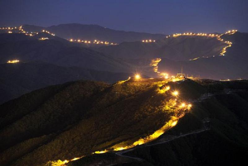
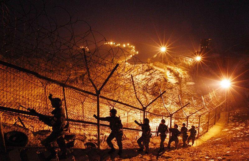
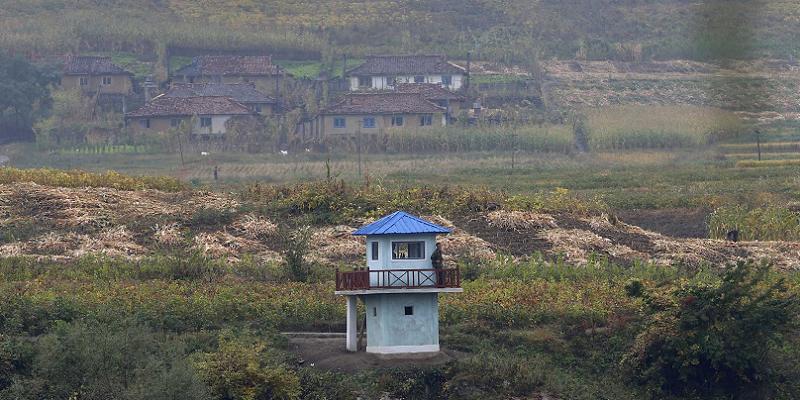
South Korea-North Korea
The 60+ million people of the Korean peninsula have a common culture, language, and history. Millions of families live on both sides of the line where UN/North Korean forces happened to be sitting when the fighting stopped in 1953. Since then, fences have gone up, snipers have been deployed, and over one million landmines have been buried. The demilitarized zone (DMZ) has spent the last 62 years (and counting) developing into a pristine wildlife refuge. bananamap
Cross-border infiltration is relatively common along the DMZ. Details of the countries' security precautions are, of course, classified, but it's a safe bet a lost skydiver who came down within range of these lights wouldn't make it to the ground alive.National Geographic
Every inch of every fence passes under seven sets of eyes on a regular, but difficult to predict, schedule. Cut one wire, and somebody up the chain of command will know about it within a day or two.Controversial Topics
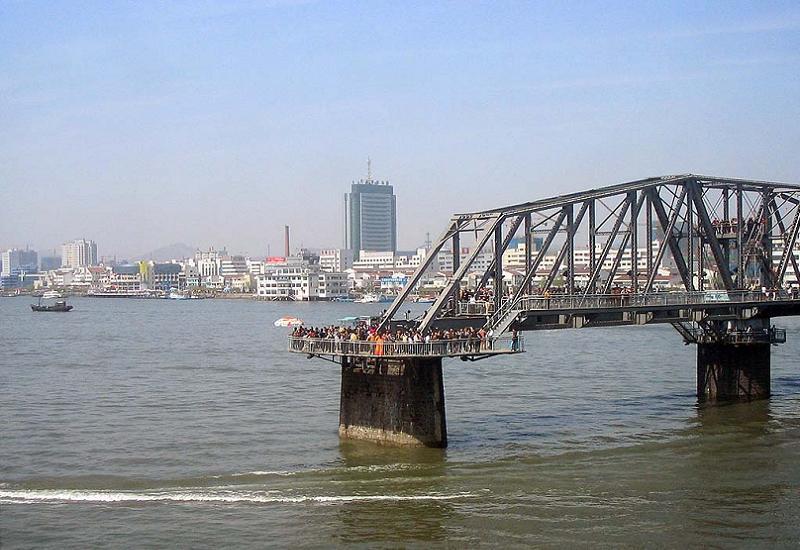
At the other end of North Korea, the Broken Bridge reaches about halfway into the Yalu River. . . then it just stops. The bridge was built in 1911 and heavily bombed during the Korean War in an effort to disrupt the flow of Chinese troops and supplies into the DPRK. North Korea refuses to repair the bridge, reportedly so that the United States won't be able to deny that it was bombed, but also partly because bridge repairs are expensive and North Korea is one of the poorest countries in the world. Another bridge runs next to it, and actually functions. Pedestrians are not allowed to step onto this bridge – presumably because of American aggression.Travel Earth - A Photographic Journey
The bonds between the People's Republic of China and the Democratic People's Republic of Korea are historically favorable, with China being North Korea’s most important ally and biggest trading partner. Intrinsic to that relationship between “free” peoples is thousands of guard towers along the river. Attempts to cross in either direction, especially if you're a loyal citizen of the DPRK attempting a brief visit to your allied neighbor, are met with an instant barrage of sniper fire. Unless you have $8,000 to bribe the garrison commander – then you can go where you want.Business Insider
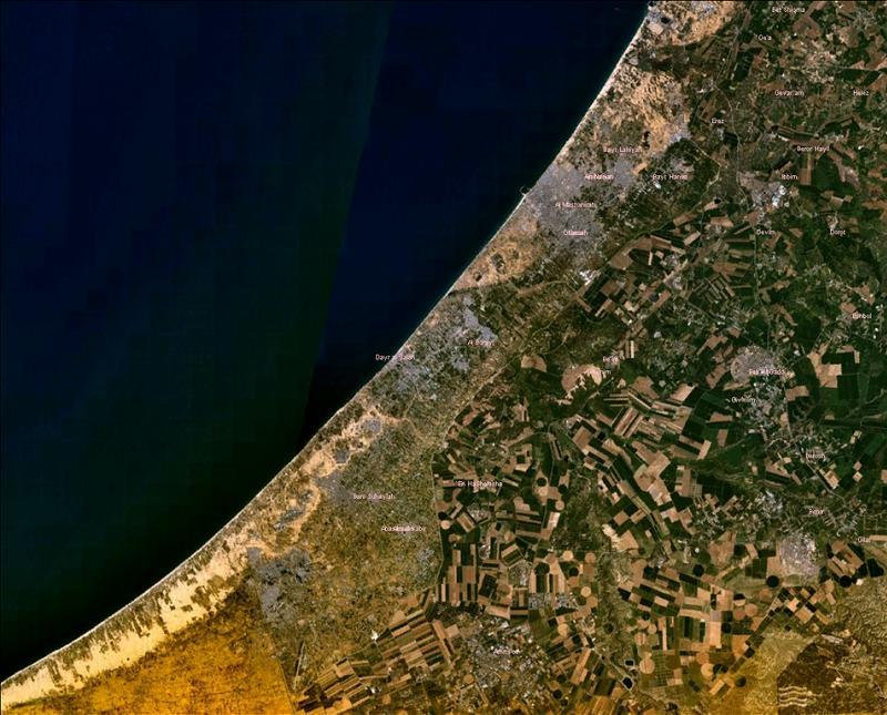
Israel-Palestine-Egypt
Can you guess which of the three countries in this image is Israel, the one with water, which is Gaza, the gigantic refugee camp, and which is Egypt, which doesn't invest heavily in irrigating the Sinai?Wikimedia Commons
Depending on who's doing the counting, this image contains around 10 countries, plus a few disputed zones and occupied territories. Every single one of these countries is involved in some kind of border dispute. Randomly drop a hand grenade from this altitude, and you'll instantly become a terrorist/freedom fighter to millions of people, no matter where it lands.YouTube