Before the rise of photography in America, artists drew stunning "balloon maps" of their cities, giving ordinary citizens a bird's-eye view of their communities that they'd never seen before.


During the late 19th and early 20th centuries, illustrated panoramic maps exploded in popularity in America.Library of Congress
Often called "balloon maps," these illustrations were sometimes drawn by artists in hot air balloons.Library of Congress
Not all "balloon maps" were drawn with the help of hot air balloons. Some artists simply sought high vantage points to create their drawings.Library of Congress
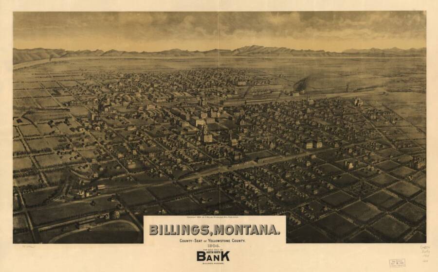
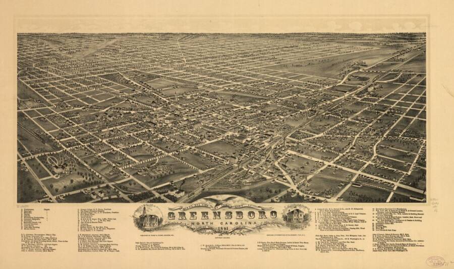
Illustrated panoramic maps were rarely drawn to scale, but they still gave people a decent overview of their local area.Library of Congress
Real estate agents often used balloon maps to sell property to people who were interested in moving to new homes.Library of Congress
Much like modern-day maps, these illustrations were often posted in the common areas of cities to help people get around.Library of Congress
Illustrated panoramic maps helped give citizens a larger sense of place in their communities.Library of Congress
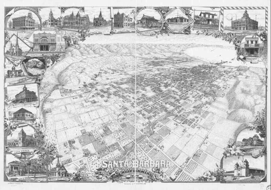
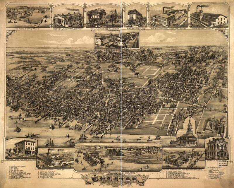
While illustrated panoramic maps started off relatively simple, artists began to add more specific details as time went on.Library of Congress
Panoramic maps not only helped local citizens navigate their cities, but also paved the way for tourists to explore as well.Library of Congress
Hundreds of vintage illustrated panoramic maps are still available for viewing today, courtesy of the Library of Congress.Library of Congress
Many citizens used panoramic maps as symbols of pride for their cities — much like city wall posters of today. Library of Congress
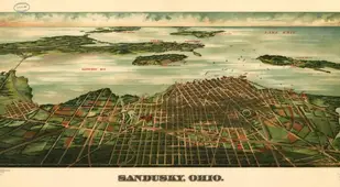
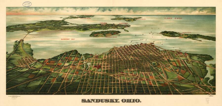
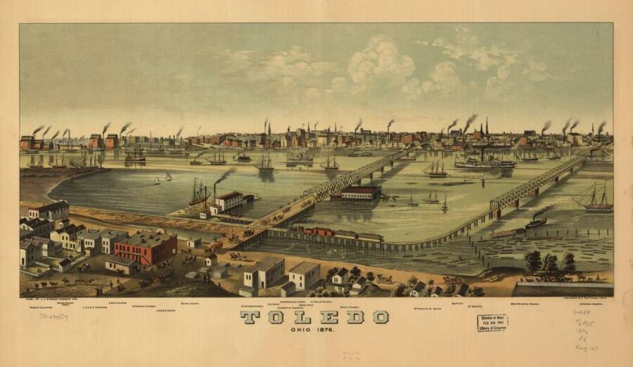
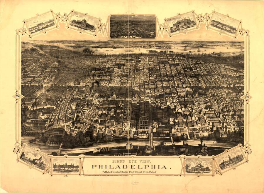
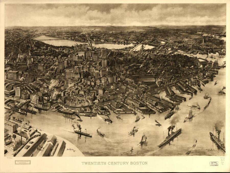
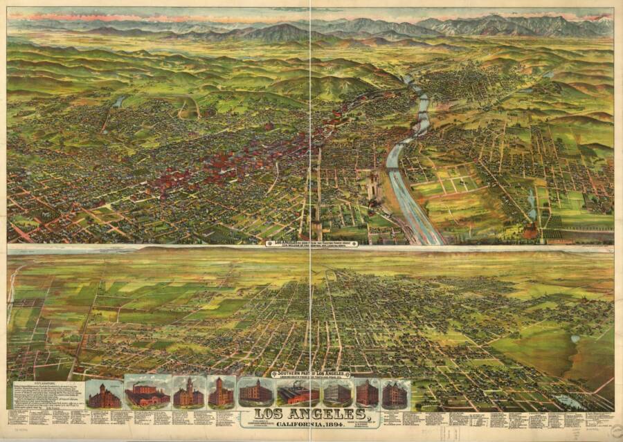
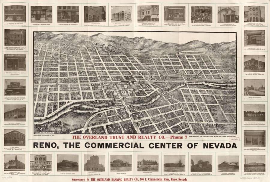
During the late 19th and early 20th centuries, illustrated panoramic maps became America's favorite drawings. Showcasing cities from above at an oblique angle, these illustrations gave people a true "bird's-eye view" of their local communities — and other places around the country.
Via hot air balloons, panoramic artists hovered above local towns and cities from various vantage points to recreate the region's skyline. The result would be a painted map based on what the artist saw while up in the air.
Although the depictions were rarely drawn to scale, these stunning drawings served as a useful overview of the area's geography. An archive featuring more than 1,500 illustrated panoramic maps is available online through the Library of Congress.
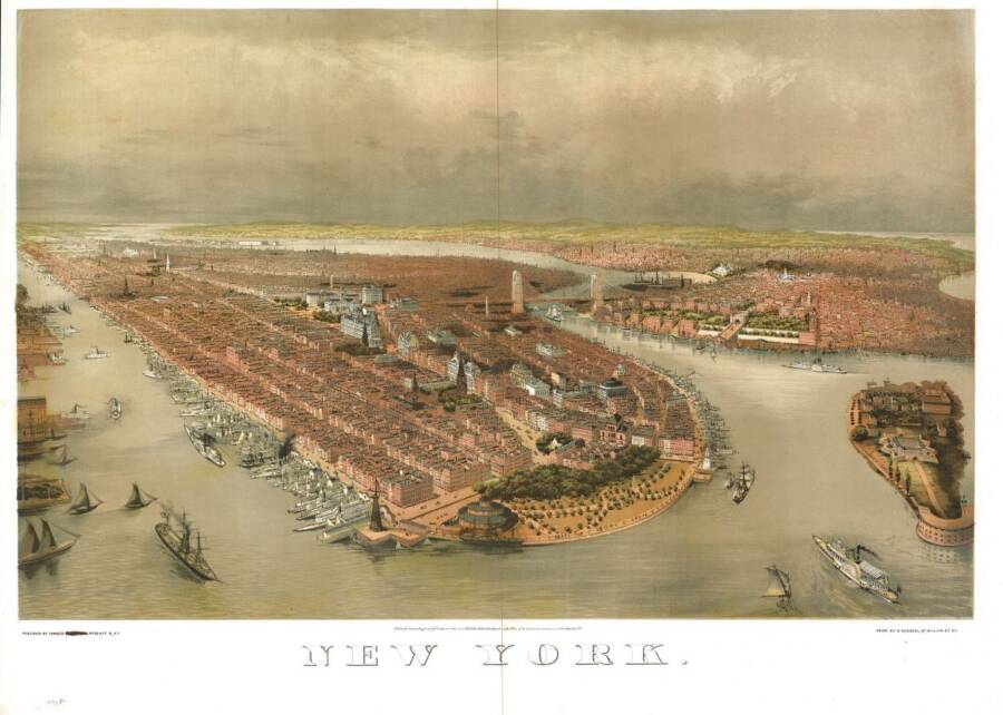
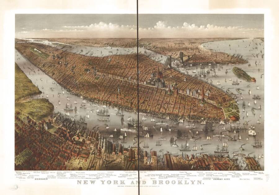
Library of CongressNew York, New York. 1874.
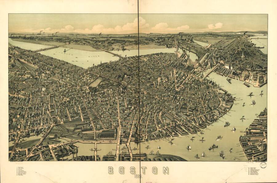
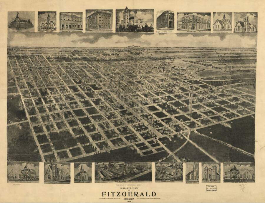
In addition to establishing a sense of place, illustrated panoramic maps were also helpful to real estate agents selling homes and business properties. As artists began to embellish these maps with more specific details, they were also used to sell dreams.
How Illustrated Panoramic Maps Aided Tourism
The illustrated panoramic maps of decades past are comparable to the Instagram photos of today. People often posted these pictures in common areas of their towns, helping citizens establish a sense of place.
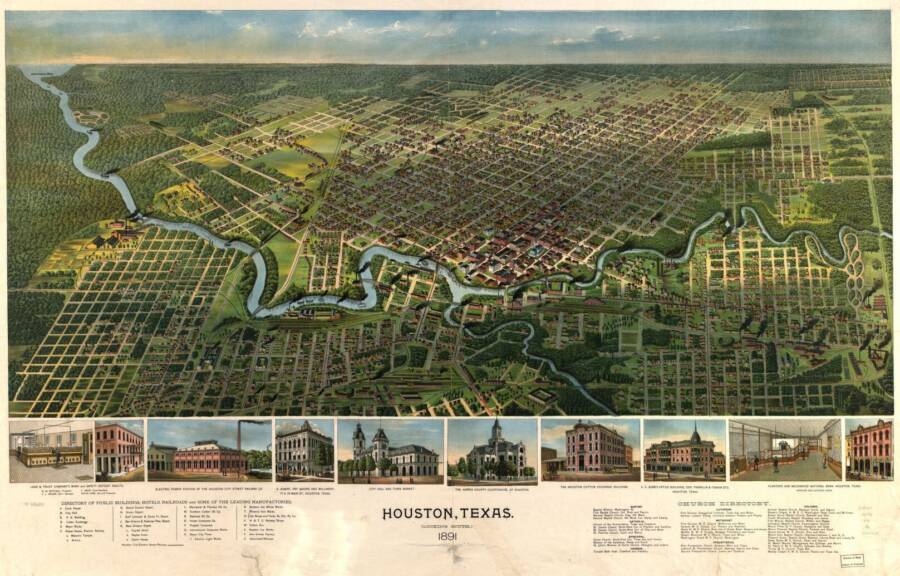
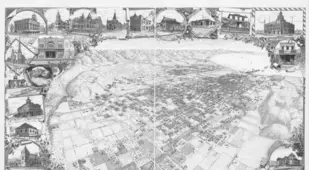
The maps also helped with tourism in the larger cities. As a result, simple panoramic maps developed into overly embellished drawings, complete with street patterns, buildings, and other major landscape features.
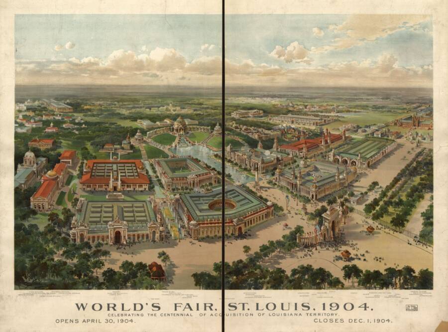
Library of CongressSt. Louis, Missouri. 1904.
Although these drawings are often referred to as "balloon maps," not all illustrated panoramic maps were drawn with the help of hot air balloons.
Most "panoramic artists" simply used high vantage points to make their drawings. Anything that would give them access to the bird's-eye view was what made their creations so popular.
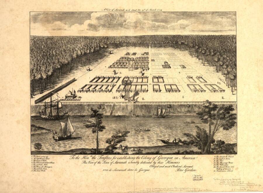
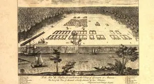
Earlier versions of the maps were more simple and basic because they served an important role during times of war.
A Bird's-Eye View Of The Future
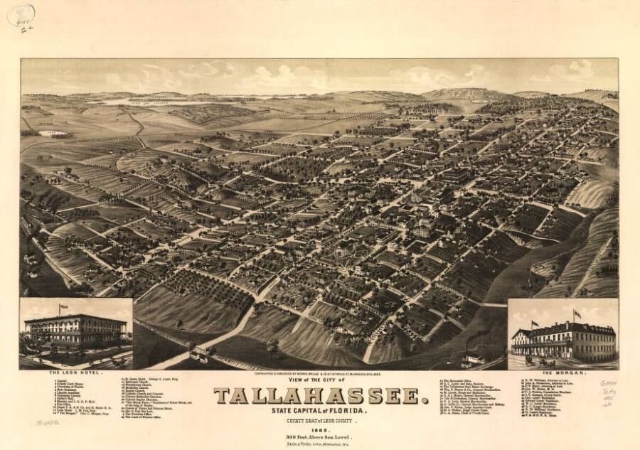
Prussian-born Albert Ruger was one of the first people ever to achieve success as a panoramic artist. He emigrated to the United States and initially worked as a mason.
While serving with the Ohio Volunteers during the Civil War, he drew views of the Union campsites. As helpful as his visual aids were during battle, his panoramic drawing style remained popular even after the war was over.
One of his most famous prints is a lithograph of Lincoln's funeral car passing the statehouse in Columbus, Ohio.
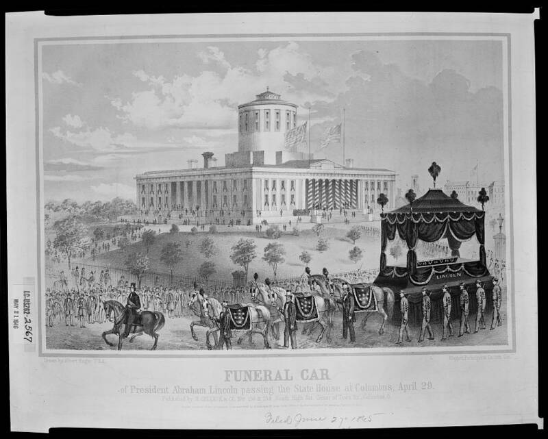
Library of CongressFuneral car of President Abraham Lincoln in Columbus on April 29, 1865.
In the Library of Congress' collection of illustrated panoramic maps, nearly 213 of them were drawn or published by Ruger. The majority came from Ruger's personal collection, which the Library purchased in 1941.
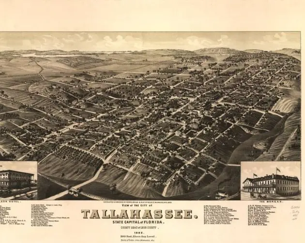
In addition to Ruger, the Library of Congress, Geography and Map Division features maps drawn by other notable artists, such as Thaddeus Mortimer Fowler, Lucien R. Burleigh, Henry Wellge, and Oakley H. Bailey.
Print makers such as Currier Ives also created panoramic maps. In mass production, these illustrations became popular wall hangings and symbols of pride — like modern day city wall posters.
The maps were especially popular in states above the Mason-Dixon line. Those states were constantly building cityscapes and bustling with activity, which gave panoramic artists something exciting to show.
But most cities in the American South were still heavily defined by farmland during the Reconstruction. Historians hypothesize that map canvassers may not have had much to depict besides plantation life.
Over the decades, illustrated panoramic maps have fallen in and out of popularity during the rise of photography.
Although mostly contemporary styles of the illustrated maps are produced today, their historical significance suggests that even before social media, Americans have always loved to overshare.
Next, check out 33 maps that explain America better than any textbook ever could. Then take a look at 29 ancient maps that show how our ancestors from the past saw the world.