Just over 8,000 years ago, a region called Doggerland that was covered in verdant forests and marshy landscapes stretched from Great Britain to Germany and the Netherlands — but it was submerged as the North Sea rose at the end of the last Ice Age.
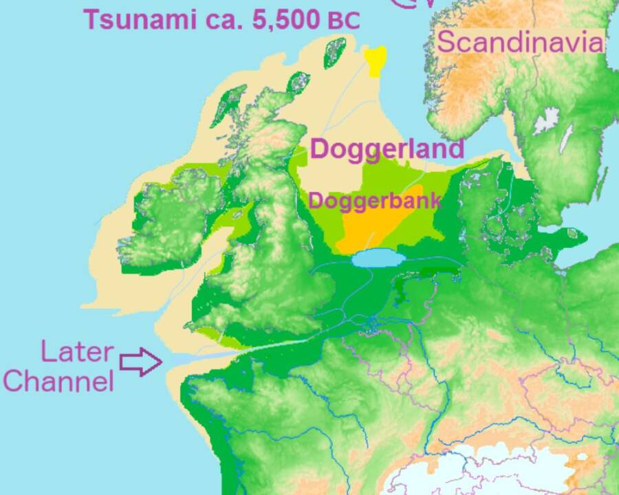
Francis Lima/Wikimedia CommonsDoggerland once stretched across what’s now the North Sea between Great Britain, Denmark, the Netherlands, and northern Germany.
Today, the North Sea is known for its treacherous waters, oil fields, and busy shipping routes. However, just over 8,000 years ago, the area was a sprawling landmass known as Doggerland.
The region, which stretched from the east coast of Great Britain to Denmark, the Netherlands, and northern Germany, was covered in lush forests and marshes. It had a thriving ecosystem and was home to Mesolithic people who hunted, fished, and gathered berries and nuts to survive. Then, as sea levels began rising at the end of the last Ice Age, Doggerland started to sink.
The hunter-gatherers who inhabited the area were forced to flee to higher ground in modern Britain and mainland Europe, and by about 6000 B.C.E., Doggerland was almost completely underwater. Some experts believe that a massive tsunami triggered by a landslide off the coast of Norway submerged what was left of the landmass.
The sunken region has even been connected to the legendary city of Atlantis. French engineer Jean Deruelle hypothesized that Plato was actually writing about Doggerland when he described the ancient civilization that sank beneath the sea. While this theory is controversial, it speaks to how much remains unknown about this lost landmass.
Uncovering The Land Beneath The North Sea
In September 1931, a British trawler called Colinda was sailing in the North Sea off the coast of Norfolk when the crew made a startling discovery. As they brought up their fishing nets, they found a large block of peat with a spearhead inside. It was about eight-and-a-half inches long, had a barbed edge, and was carved from a deer antler.
Experts later examined the artifact and determined that it was about 13,000 years old. So, what was it doing in the middle of the North Sea?
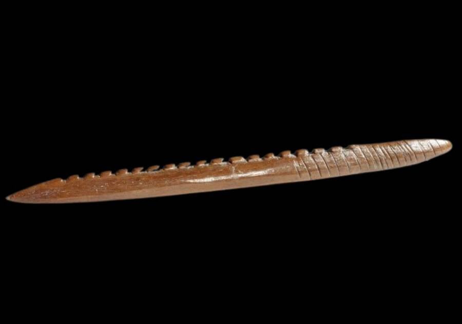
Cromer Museum/FacebookThe 13,000-year-old bone spearhead uncovered by the Colinda in the North Sea in 1931.
Mesolithic hunter-gatherers wouldn’t have had the sailing technology to travel so far from the shoreline, so they couldn’t have dropped it into the water during a fishing expedition. What’s more, analysis of the peat showed that it had formed in a freshwater environment.
Over the course of the next century, fishermen and inhabitants living along the coast of the North Sea continued to come across artifacts that suggested the area hadn’t always been underwater. As more and more objects turned up, scientists determined that the sea must have been a stretch of dry land at some point in history.
As Luc Amkreutz, the curator of prehistoric collections at Leiden’s National Museum of Antiquities, told Archaeology Magazine in 2022, “[The spearhead is] an important object because the idea became clear that not only was this a landscape that was not always a sea, but that it must have been one inhabited by humans.”
In the 1990s, archaeologist Bryony Coles dubbed the sunken landmass Doggerland after the Dogger Bank, a sandbar in the North Sea named after Dutch boats called “doggers” that frequently fished there. However, while scientists knew there was more to be uncovered about the lost region, the rough and murky waters of the sea made it difficult for divers to study the bottom. So, they turned to a surprising source for help: offshore oil and gas companies.
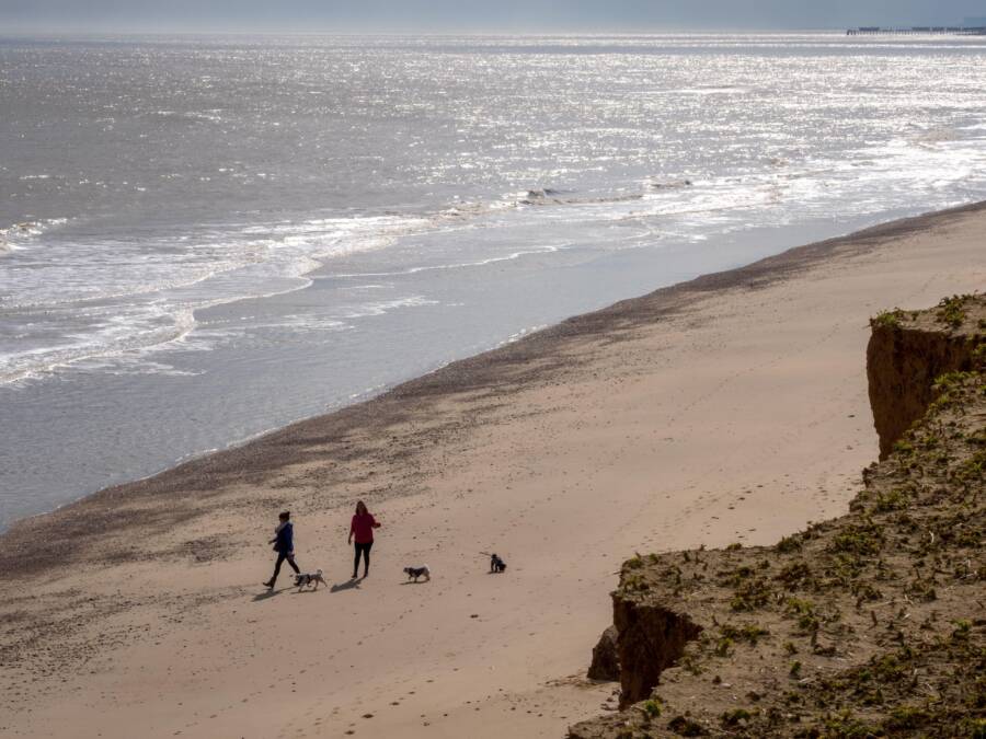
Richard Splash / Alamy Stock PhotoThe east coast of Suffolk looking out at the North Sea, where the forests and marshes of Doggerland once stood.
These corporations had been carrying out seismic surveys for decades, and the data they collected could be used to create digital maps of the seafloor — the former surface of Doggerland. These maps revealed that the landmass had been covered in forested hills, valleys, lakes, rivers, and marshes.
While Doggerland had connected Britain to mainland Europe, it was more than just a land bridge — it was home to generations of Mesolithic hunter-gatherers.
What Was Life Like In Prehistoric Doggerland?
Over the past century, the prehistoric artifacts recovered from the southern North Sea have painted a vivid picture of life in Doggerland thousands of years ago. Spear points and arrowheads made of bone show how inhabitants hunted for their food, while the bones of mammoths, deer, and wild boar reveal what they ate. Pollen found in sediment cores from the seafloor points to the types of plants that grew in the region, including willows, hazel trees, and shrubs that produced various berries.
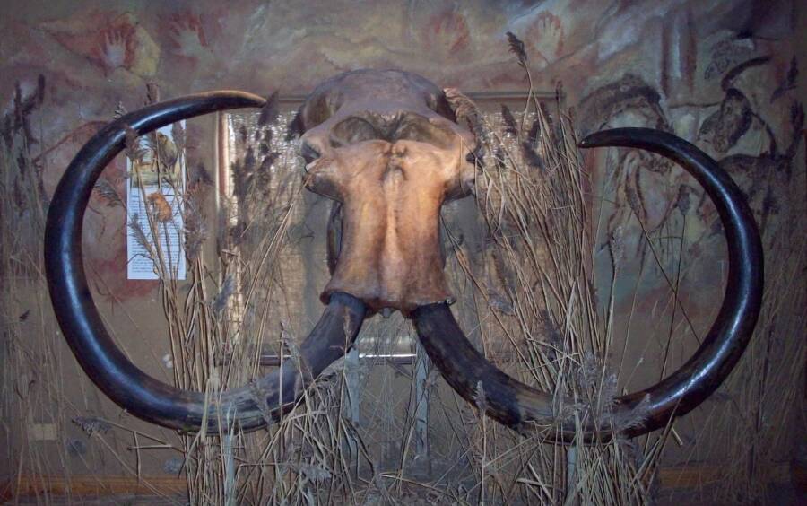
Ogmios/Wikimedia CommonsThe skull of a woolly mammoth found by a fisherman in the North Sea off the coast of the Netherlands in May 1999.
The hunter-gatherers who lived in the region were nomadic and moved around as the seasons changed to track down food. These prehistoric people first came to Doggerland during the time of the Neanderthals. Occupation continued for tens of thousands of years as Neanderthals died out and modern humans took over.
Scientists have even found the preserved remains of some of Doggerland’s former residents, such as an 8,300-year-old jawbone with teeth still attached. Other human bones dredged up from the seafloor contain strange marks that suggest the Mesolithic people of the region performed rituals on their dead.
As the last Ice Age came to an end around 11,000 years ago, life started to change for the hunter-gatherers of the region. Their seasonal hunting grounds flooded first, and then the rest of the landmass slowly became submerged. Some researchers believe this continued for thousands of years until the entirety of Doggerland was underwater, but others think the process was hastened along by a tsunami around 6200 B.C.E. This disaster was triggered by the Storegga Slide, an underwater landslide that occurred off the coast of Norway.
In the 20th century, French engineer Jean Deruelle hypothesized that this event was what Plato was really describing in his works Critias and Timaeus, which tell of the lost civilization of Atlantis. In fact, he suggested that Doggerland was Atlantis. According to Deruelle, the city was a “great plain,” not an island, and the ditch Plato said surrounded Atlantis was actually a dyke meant to keep out the rising North Sea.
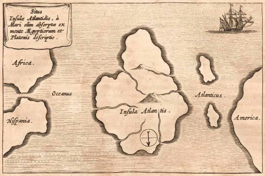
Public DomainA 1678 map of Atlantis, the lost civilization that has been connected to Doggerland.
Scientists have largely dismissed Deruelle’s theory, and they also continue to debate whether or not the tsunami was the final nail in the coffin for Doggerland or if it was simply subjected to rising sea levels over time. Regardless of how the region ultimately sank, the last humans were forced to flee about 8,000 years ago — and the landmass was lost to history for millennia.
Recent Research Into Doggerland’s Hidden History
In 2019, scientists found a fossilized forest beneath the North Sea that renewed their hope of uncovering more about the region’s history. As archaeologist Vincent Gaffney told Live Science at the time, “We are absolutely dead sure that we are very close to a settlement… We have now identified the areas where the Mesolithic land surface is close to the surface [of the seafloor]. So we can use the dredges or grabs to get larger samples of whatever that surface is.”
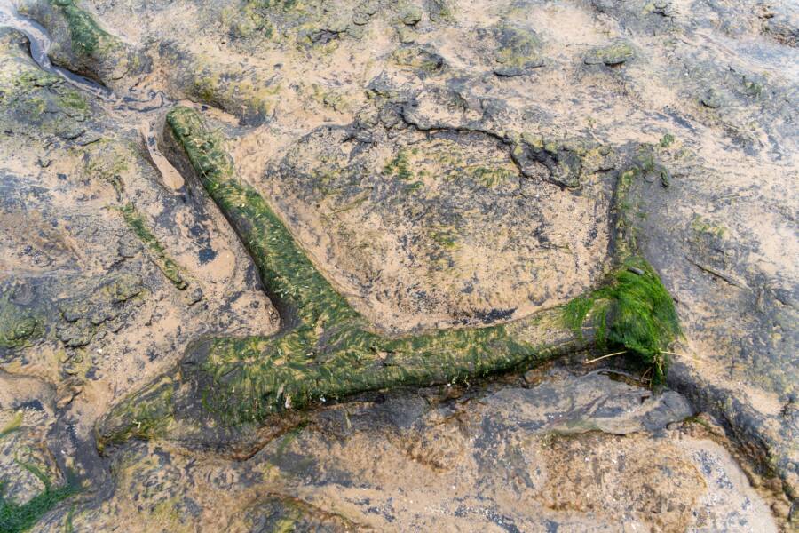
Hazel Plater / Alamy Stock PhotoThe remains of a petrified prehistoric forest from the North Sea, once part of Doggerland.
While a century of research has revealed thousands of Mesolithic artifacts, scientists have yet to come across any of the hunter-gatherer settlements that once dotted Doggerland. Gaffney and his team aimed to search areas that were previously marshes, identifiable by the presence of compressed peat, for the best chances of finding evidence of human habitation. “The optimum areas are wetlands, where there [were] water, birds, fish, and shellfish,” Gaffney told Live Science.
Researchers also hope that learning more about Doggerland — and its ultimate fate — will serve as a cautionary tale when it comes to climate change. Though the global warming that caused the prehistoric landmass to sink occurred naturally, human-accelerated changes are currently affecting the world’s climate.
This rapid shift is expected to lead to a rise in sea levels, which could spell disaster for coastal communities — which may one day find themselves in the same position as Doggerland.
After learning about Doggerland, discover whether or not Atlantis is real. Then, go inside the stories of 13 incredible sunken cities from around the world.