A new image from NASA shows how a tornado that hit Kentucky in May made its mark through Daniel Boone National Forest.
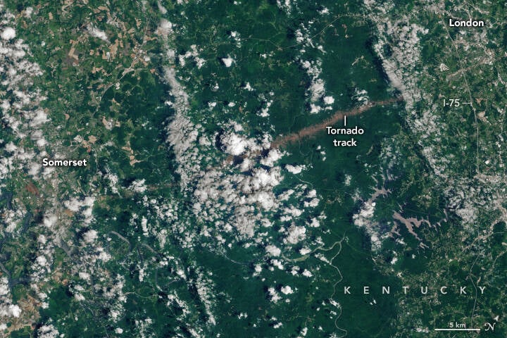
NASA Earth ObservatoryA satellite image of the scar left behind by a tornado that struck Kentucky on May 16, 2025.
The path a deadly tornado made through Daniel Boone National Forest in Kentucky can be clearly seen in new satellite imagery released by NASA. The twister, which struck the state on May 16, 2025, left behind a catastrophic trail of destruction and took 20 lives.
The tornado touched down around 10:30 p.m. and traveled nearly 56 miles through three counties. The National Weather Service rated it an EF-4, making it one of the strongest and deadliest storms to ever strike Kentucky.
The Deadly Tornado That Ripped Through Kentucky
The May 16 tornado touched down near Whittle, Kentucky, just after 10:30 p.m. As it roared east, it ripped the bark off of trees, threw houses from their foundations, and tore a high-tension power pole from the ground and threw it hundreds of yards. It lifted at 11:56 p.m. after traveling 55.6 miles.
The twister also killed 20 people, including 17 in Laurel County alone. The other three deaths occurred in Russell and Pulaski Counties.
The National Weather Service rated the twister an EF-4 on the Enhanced Fujita scale, which rates the severity of tornadoes based on wind speeds, which are estimated from the damage left behind. This tornado reached speeds of up to 170 miles per hour, making it one of the strongest to ever hit the area.
The storm’s power is evident in a new photo released by the NASA Earth Observatory. The satellite image, which was captured by Landsat 9, shows a distinct brown mark on the Earth’s surface that the tornado carved through Daniel Boone National Forest.
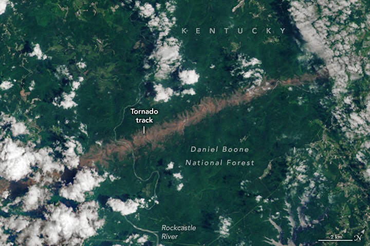
NASA Earth ObservatoryThe scar indicating the tornado’s path is labeled on this satellite image of the resulting storm damage.
The twister reached its widest point in the forest, leaving behind the mile-wide path of destruction seen in the image.
How Tornadoes Are Changing Across The United States
The frequency of tornadoes in the U.S. has slightly declined over the past few years. However, the places where tornadoes strike most frequently have started to shift from the Midwest to the Southeast.
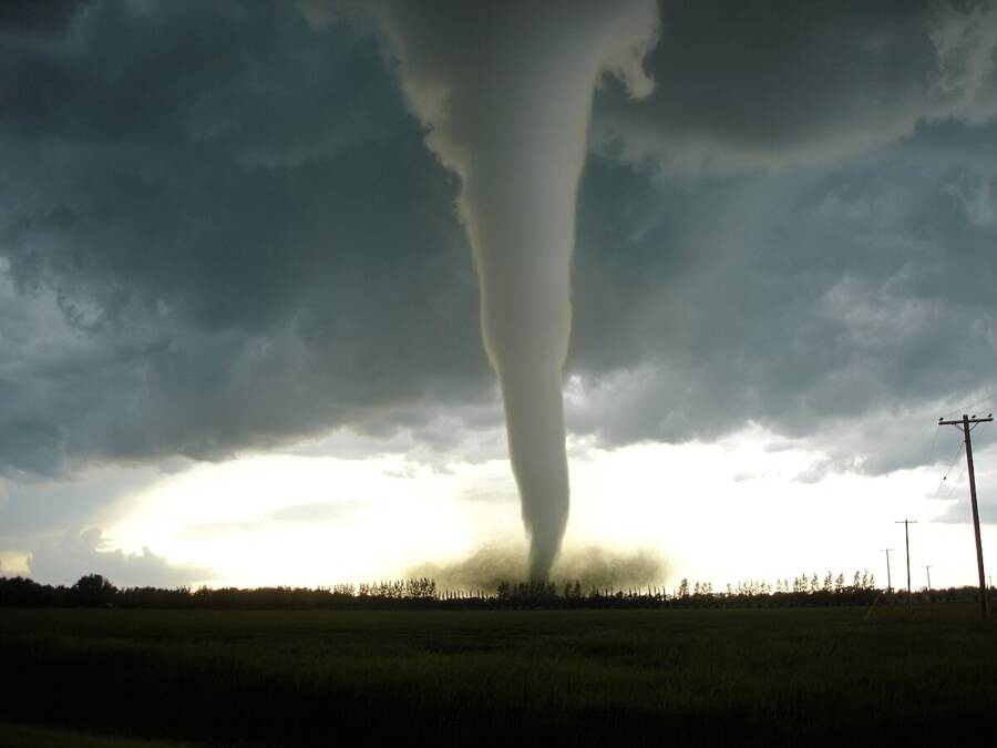
Justin Hobson/Wikimedia CommonsTornadoes are becoming increasingly common in regions of the southeastern United States.
This means that Southeastern states, which previously had not endured such storms at this rate, are now learning to manage the damage that comes along with them — particularly damage to forests. The scar left through Daniel Boone National Forest is a visible reminder of how tornadoes can create complications when it comes to forest management, ecosystem sustainability, and carbon storage.
Additionally, the National Weather Service station in the region where the tornado hit no longer has overnight staff due to changes in the federal government and had to call in workers to respond to the tornado, as Brady Africk, the deputy director of media relations and data design at the American Enterprise Institute, stated in a newsletter.
“This round of severe weather renewed some meteorologists’ concerns over cuts to National Weather Service (NWS) stations, including those that provide weather updates to rural communities,” Africk wrote.
Meanwhile, Governor of Kentucky Andy Beshear said in a statement regarding the storm, “I promise that we will be there for our people until every home and every life is rebuilt. And I want to thank all our heroic first responders for the work they’ve done over the past few days. This is another incredibly tough time for Kentucky. And it’s another reminder that life is short, and it’s our duty to be kind and do good.”
After reading about the tornado scar through a Kentucky forest that’s visible from space, look through 15 terrifying photos of fire tornadoes. Then, learn about deadly Galveston Hurricane of 1900.