Dating back 2,000 years, this Maya metropolis contained 6,674 structures, including pyramid temples, amphitheaters, and a reservoir.
Luke Auld-Thomas et al./Cambridge University PressTraces of the lost Maya city, named Valeriana, as seen with LiDAR technology.
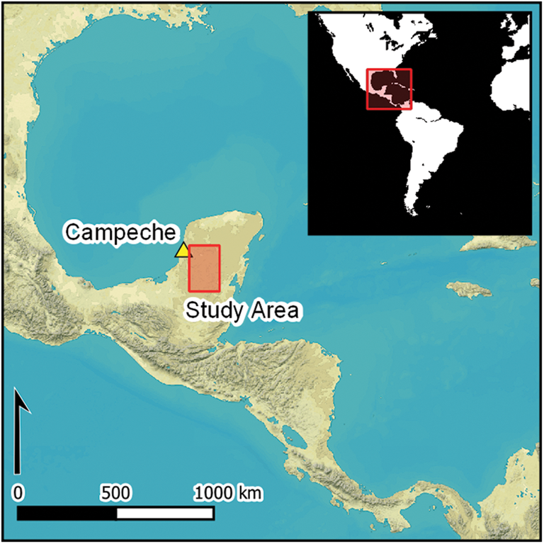
Locals in the Mexican state of Campeche had always suspected that there were Maya ruins hidden beneath their feet. But it took a curious archaeologist — and a creative usage of LiDAR technology — to confirm their suspicions. Not only were there Maya ruins, but ruins of a great city that had “all the hallmarks of a Classic Maya political capital.”
There’s still much to learn about this city, which researchers have named Valeriana after a nearby freshwater lagoon, but the LiDAR images suggest that it once thrived as a nearly unparalleled metropolis some 2,000 years ago.
Researchers Use LiDAR Technology To Uncover The Lost Maya City Of Valeriana
Luke Auld-Thomas et al./Cambridge University PressBy looking at previously-conducted LiDar surveys, archaeologists were able to locate a lost Maya city in the Mexican state of Campeche.
The discovery of Valeriana came about in an unusual way. In the past several years, archaeologists have frequently turned to LiDAR technology to uncover lost communities (just recently, the technology was used to locate a Portuguese settlement deep in the Amazon). But LiDAR can also be expensive. So, Luke Auld-Thomas, an anthropologist at Northern Arizona University, began his search for lost Maya cities by pouring over LiDAR surveys that had been previously conducted by other organizations.
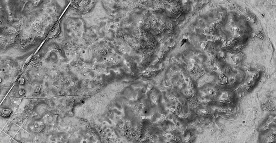
While looking at data compiled in 2013 by a forest monitoring project, Auld-Thomas began to make out the telltale signs of a Maya metropolis.
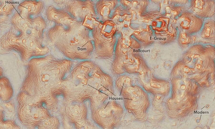
Luke Auld-Thomas et al./Cambridge University PressThough aerial views of the site show nothing but green jungle, LiDAR technology revealed certain patterns that archaeologists can use to identify houses, temples, and more.
As Auld-Thomas and his fellow researchers wrote in a study published in the journal Antiquity, they found the city of Valeriana in the Mexican state of Campeche. It was probably founded before 150 C.E. (Maya civilization reached its peak between 250 and 900 C.E.) and contained several elements that suggest it was once a thriving urban center.
The Rise And Fall Of Valeriana, The Maya City Hidden In The Mexican Jungle
For now, many questions still remain about Valeriana. But archaeologists can glean clues about the city’s size and importance from the LiDAR images that Auld-Thomas uncovered. Because of those images, archaeologists believe that Valeriana was once an important Maya city, part of which was densely packed into the 50 square miles which the LiDAR data covered.
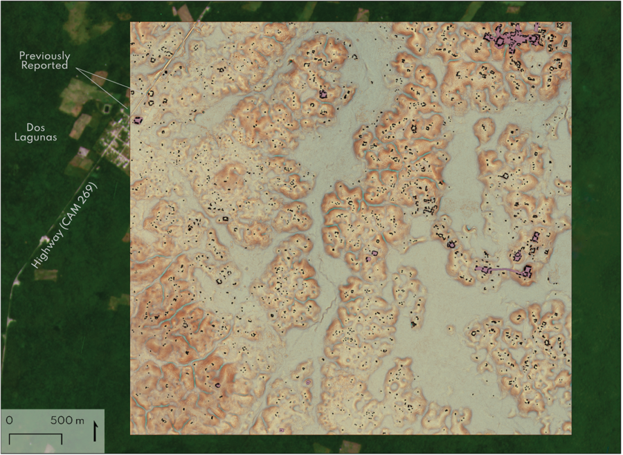
Luke Auld-Thomas et al./Cambridge University PressLiDAR data concerning the lost Maya city of Valeriana, overlaid with the forest cover as seen from above.
In their study, they wrote that Valeriana had “all the hallmarks of a Classic Maya political capital,” including “multiple enclosed plazas connected by a broad causeway; temple pyramids, a ballcourt [and] a reservoir. The layout of the city suggests it was built prior to 150, and the settlement seems to continue past the data set images roughly three miles to the north.”
So what happened to Valeriana? How did this mighty Maya city crumble into ruins — ruins which are no longer even visible to the naked eye?
Though an exact answer may be hard to come by, it’s likely that Valeriana met the same fate as other Maya cities. One recent study suggested that the fall of the Maya came because of climate change. Faced with huge decreases in rainfall and devastating droughts, the civilization collapsed.
As such, Valeriana fits into a much larger history of the Maya civilization. And it also demonstrates the potential of LiDAR technology — both when used by archaeologists and when compiled by other organizations.
In the words of Auld-Thomas, “The government never knew about it, the scientific community never knew about it. That really puts an exclamation point behind the statement that no, we have not found everything, and yes, there’s a lot more to be discovered.”
After reading about the lost Maya city that was discovered thanks to LiDAR technology, discover the story of Camazotz, the terrifying “death bat” of ancient Maya myth. Then, learn about El Castillo, the awe-inspiring 79-foot Maya pyramid that was built between 1050 and 1300.