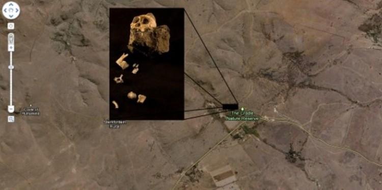
Ancient Human Ancestor, South Africa
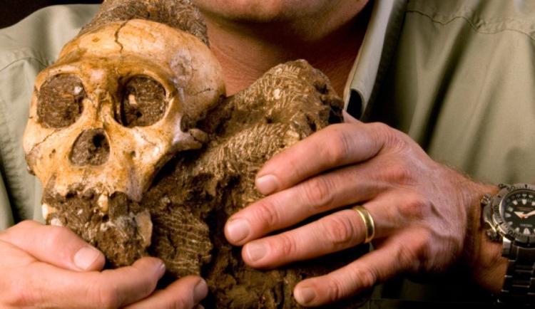
Plucky paleoanthropologist Professor Lee Berger used Google Earth (from the comfort of his armchair) to find bones of an ancient human ancestor in South Africa. After isolating patterns in a region he thought most likely to house human remains, Berger led a small contingent (his dog, son and one student) to the caves and fossil sites.
The hunch paid off: Berger discovered 50 previously unidentified caves and fossil sites, one of which contained perfectly preserved human remains dating back 2 million years.
The compelling part of the discovery is that the fossils were not completely human, but rather a transitional species that could potentially tell us about human evolution.
Villa Remains, Rome
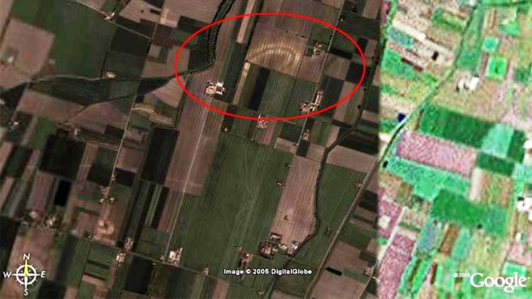
One of the earliest incidences of Google Earth being used as an archaeological tool occurred in 2005. Ironically, the man responsible – Luca Mori – was simply using it to observe his local area. Instead, what he discovered was the location of an ancient Roman villa located near his home in Parma.
The satellite imagery revealed a dark oval shape, which Mori mistook for a technological glitch. It wasn’t until after he alerted the National Archaeological Museum, and their expedition unearthed ancient ceramic pieces, that the site was confirmed as a villa from a Roman era before Christ.
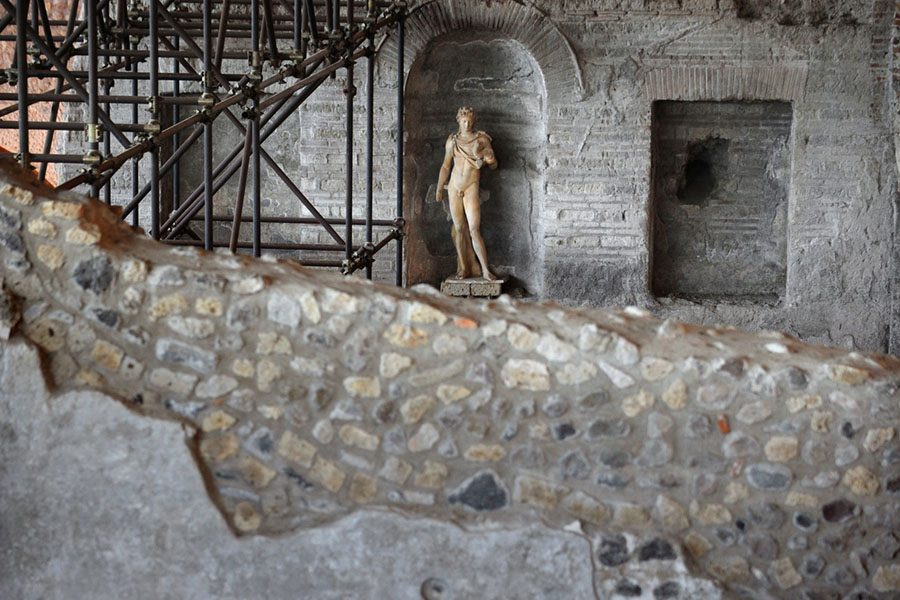
MARIO LAPORTA/AFP/Getty ImagesThe excavation site of the Dionysiac Villa near Naples, southern Italy.
Mount Mabu, Mozambique
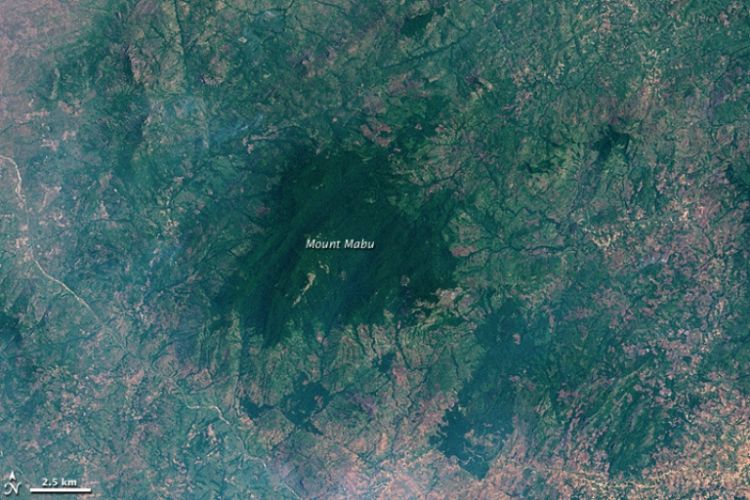
War-torn and geographically treacherous, Mozambique provides numerous obstacles for explorers.
But thanks to Google Earth, a British scientist at Kew Royal Botanic Gardens, Julian Bayliss, stumbled upon the magnificent acres of rainforest in Mount Mabu – an area that had hitherto been uncharted. In 2008, a group of scientists embarked on an expedition and ended up finding over a hundred new species – plants, birds, butterflies, monkeys, snakes – in just three weeks.

YOSHIKAZU TSUNO/AFP/Getty ImagesA type of pygmy chameleon, similar to the one above, was among the new species discovered in the forests of Mount Mabu.
Mount Mabu was well known to locals in Mozambique, but because of it’s accidental discovery by outsiders it is nicknamed the “Google Forest.”
In 2009, the government of Mozambique announced that it would take measures to protect the forest from logging because several species of birds found there are classified as globally threatened.
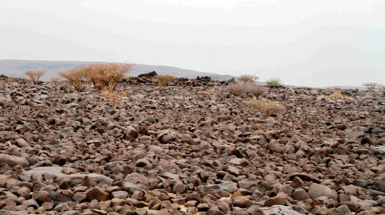
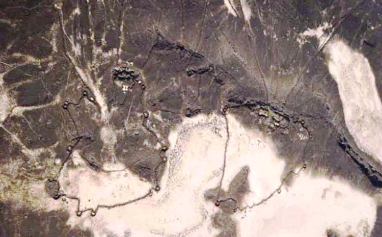
Stone Structures, Saudi Arabia

Much like Mozambique, Saudi Arabia is a harsh terrain difficult for researchers and explorers. Earlier this year, a professor in Western Australia, David Kennedy, solved this dilemma by scouring the region via Google Earth and in the process uncovered over 2000 potential archaeological sites.
The discovery unearthed thousands of prehistoric man-made stone structures – stone wheels, ancient animal traps, tombs shaped like kites – stretching from Syria to Yemen. He also conducts annual flights over Jordan for the Aerial Archaeology project, which collects images of the area for study. Professor Kennedy believes these items to be over 9000 years old.
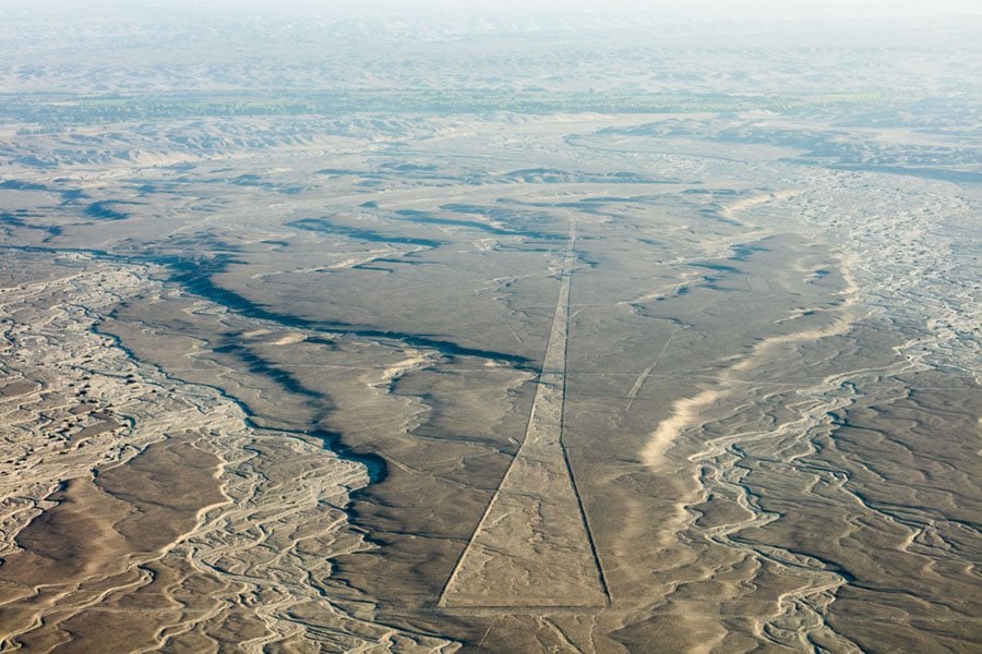
Among his discoveries is a 93-mile-long wall in Jordan.
Though the wall was first spotted in 1948, Kennedy and his team are trying to decipher exactly who built it and what purpose it served. They are so far convinced that the wall wasn’t used for defensive purposes, and speculate it could have been used to mark boundaries between farms.
Pyramids, Peru

In 2008, scientists uncovered a buried pyramid in the Peruvian desert using Google Earth and some special algorithms. The pyramid is located underneath a crop field, a mile away from the famous Nazca Lines in the Cahuachi desert.
Researchers used a combination of satellite imagery and infrared technology to peel away the top layer imagery and uncover the pyramid, which is said to extend over an area of 9000 square meters.
Wikimedia Commons Nazca, Peru
If you enjoyed this look into the Earth’s mysteries uncovered by Google maps, check out our gallery of Google Earth images from past and present that paint a bleak picture.