Researchers believe that engravings uncovered on the floor of the Ségognole 3 cave in France's École River Valley may represent the oldest 3D map in world history.
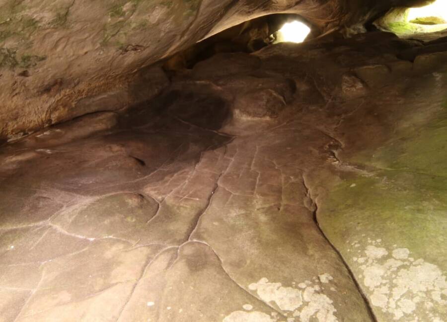
Pascal Crapet, Fontainebleau/Courtesy of Médard Thiry for labrujulaverde.comThe carvings discovered on the floor of Ségognole 3 cave outside of Paris that may represent the oldest 3D map in the world.
Deep within a French cave, researchers may have uncovered the world’s oldest 3D map.
While exploring the Ségognole 3 cave just south of Paris, scientists found engravings on its floor resembling the geographic features of the surrounding École River Valley, potentially suggesting that this was a purposefully designed scale model.
These intricate carvings, created by Paleolithic hunter-gatherers more than 20,000 years ago, likely served both practical and spiritual purposes. If that’s true, this discovery is an historic find that broadens our understanding of the capabilities of early human societies.
Researchers Discover A Possible 3D Map On The Floor Of Ségognole 3 Cave
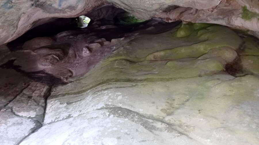
Pascal Crapet, Fontainebleau/Courtesy of Médard Thiry for labrujulaverde.comThe interior of the Ségognole 3 cave.
In 2020, scientists exploring the Ségognole 3 cave in France’s École River Valley, just south of Paris, discovered curious engraved lines on the cave’s floor.
After observing the flow of water through the engravings, the researchers realized that the lines were organized and purposeful.
Researchers discovered that the lines on the cave floor, dating back more than 20,000 years, bore remarkable similarities to waterways, hills, and other geographic features of the surrounding valley itself. Now, in a study published in the Oxford Journal of Archaeology, scientists hypothesize that these cave floor engravings represent a scale model of the local environment, making this perhaps the oldest 3D map in the world.
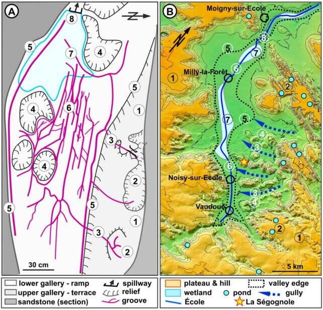
Thiry and Milnes/Oxford Journal of ArchaeologyThe 3d map found inside the cave, compared to the École River Valley where it is located.
“The carved motifs and their relationship with natural features in the sandstone of the shelter can be compared with major geomorphological features in the surrounding landscape. The engraved floor is not quite a map but more like a model in miniature of the surrounding landscape, potentially a world-first 3D model of a Paleolithic territory,” researchers wrote in their study.
If confirmed to be a 3D map, this discovery offers fascinating insights into the cognitive capabilities and spiritual practices of Paleolithic communities.
Further Uses And Implications Of The Paleolithic Cave Map Found In France
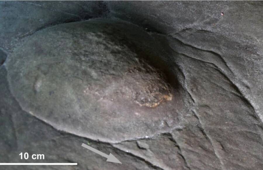
Thiry and Milnes/Oxford Journal of ArchaeologyA mound on the cave floor that may have served as a hill in the map.
The new study emphasizes how hunter-gatherers 20,000 years ago created these cave engravings to not only likely serve as a map, but also to chart environmental conditions.
As water flowed into the cave through fissures in the ceiling, it would have traveled along the paths of the engravings, filling in depressions, basins, and other waterways, much in the way that rain outside the cave would have affected the local environment. This could have provided hunter-gatherers with the knowledge necessary to predict the impacts of rain on their environment and its consequences for hunting.
Additionally, the engravings contain carvings symbolic of the female reproductive system, including vulva-shaped depressions. Cave art of animals, such as horses, has also been found in Ségognole 3. Researchers believe these details prove the map was more than just practical, but also spiritual.
“The natural geomorphological characteristics of the Ségognole 3 shelter thus provided appropriate disposition to imprint this fragmented representation of femininity, a theme that shows clear importance during the Upper Paleolithic,” researchers wrote in the study.
If confirmed as the world’s oldest 3d map, this exciting discovery could transform modern understanding of Paleolithic communities.
After reading about what may be the world’s oldest 3D map, dive into 35 historical maps that will change the way you see the world. Then, read about the Nebra Sky Disk, the oldest map of the universe ever discovered.