1 of 34
The Hindenburg flies over New York City, just hours before meeting its fateful end. 1937.The Metropolitan Museum of Art
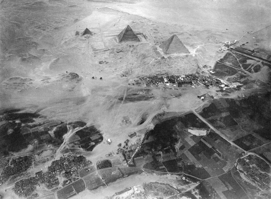
3 of 34
A view of Giza and the Great Pyramids. 1904.Wikimedia Commons
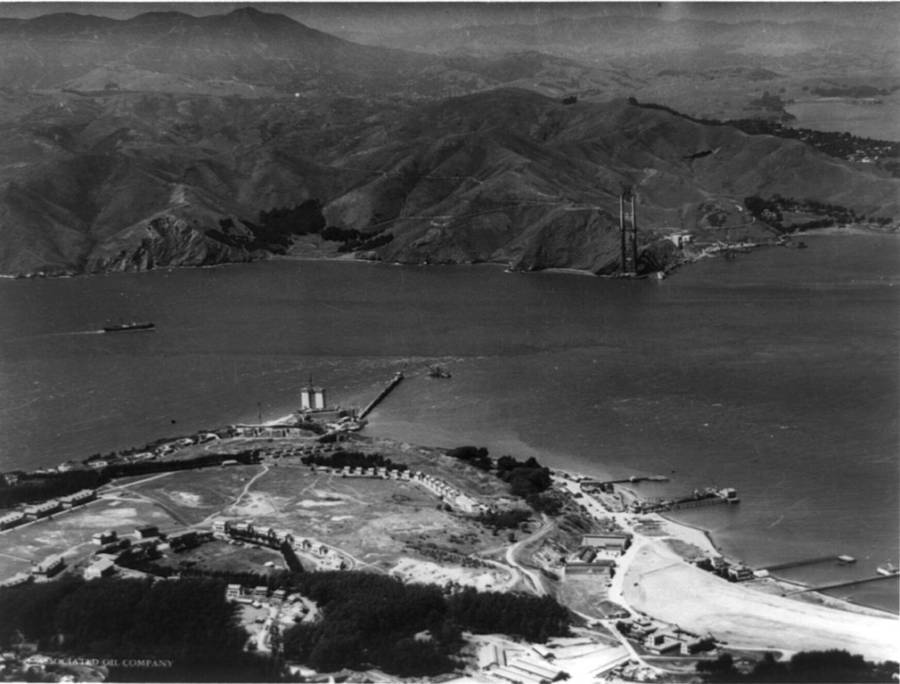
4 of 34
The first pieces of the unfinished Golden Gate Bridge sit along the San Francisco coast. 1934.Wikimedia Commons
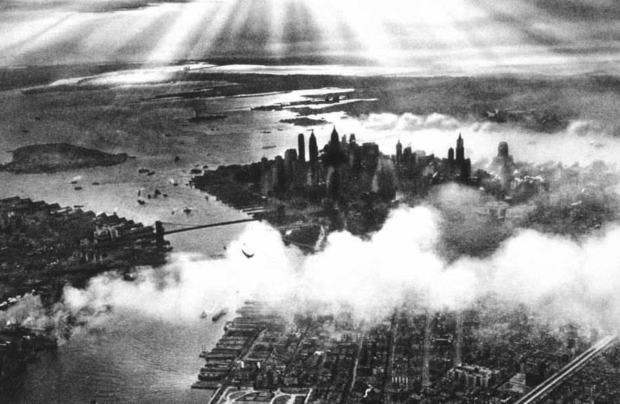
5 of 34
The sun sets over the smog, clouds, and skyscrapers of New York. 1932.Wikimedia Commons
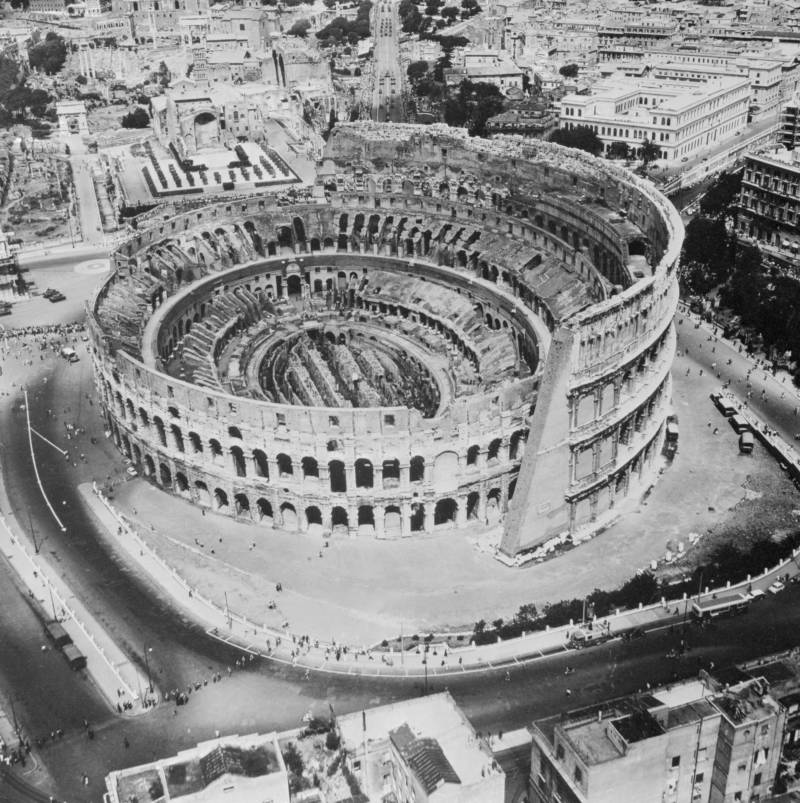
6 of 34
An aerial photo of the Colosseum in Rome. Date unspecified.Library of Congress
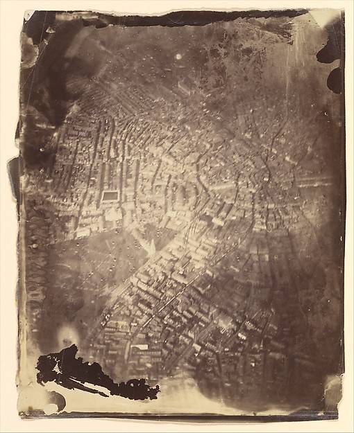
7 of 34
This image — taken of Boston in 1860 — is widely believed to be the oldest surviving aerial photo ever taken.Library of Congress
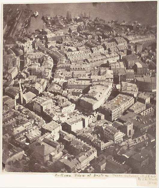
8 of 34
Boston, as seen from a hot air balloon. Circa 1860.The Metropolitan Museum of Art
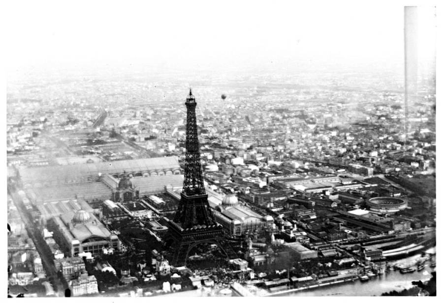
9 of 34
A view of the Eiffel Tower and the surrounding parts of Paris. 1889.Library of Congress
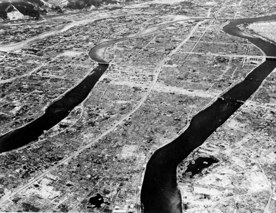
10 of 34
Aerial images of Hiroshima before and after the atomic bombing, with ground zero noted by bullseye. 1945.U.S. Department of Defense
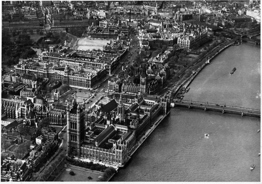
12 of 34
An aerial view of the Palace of Westminster and Big Ben on the banks of the Thames River in London. Circa 1900.Jack Benton/Archive Photos/Getty Images
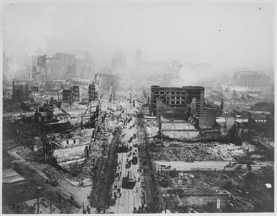
13 of 34
Buildings still in shambles following the San Francisco earthquake of 1906.Wikimedia Commons
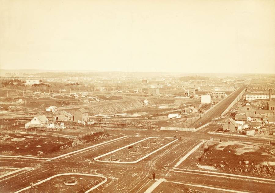
14 of 34
The Carnegie Hill section of New York, long before skyscrapers. 1882.The New York Historical Society
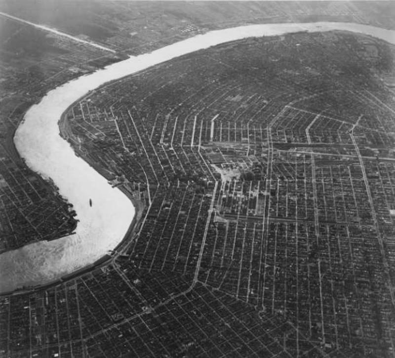
15 of 34
The Mississippi River snakes through New Orleans. 1951.Wikimedia Commons
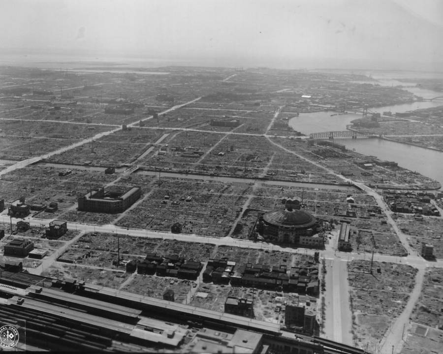
16 of 34
Tokyo lies in ruins after the bombings of World War II. Circa 1945.Wikimedia Commons
17 of 34
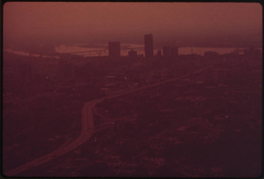
Smog envelops Louisville, Ky. in this photo taken as part of the Documerica project to document pollution in the U.S. 1972.U.S. National Archives 18 of 34
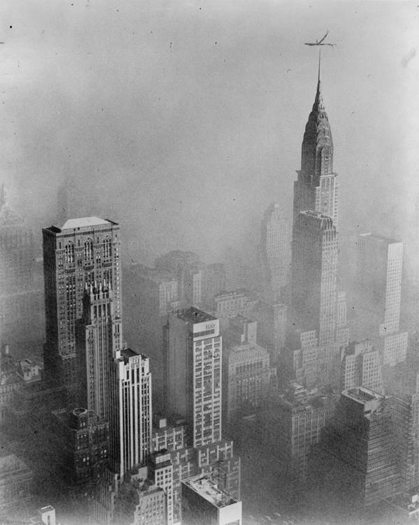
Smog obscures New York's Chrysler Building. 1952.Library of Congress
19 of 34
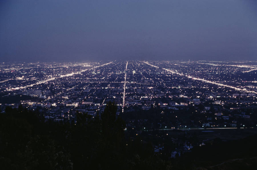
Aerial view of Los Angeles at night, as seen from the Griffith Observatory. Circa 1962.Archive Photos/Getty Images
20 of 34
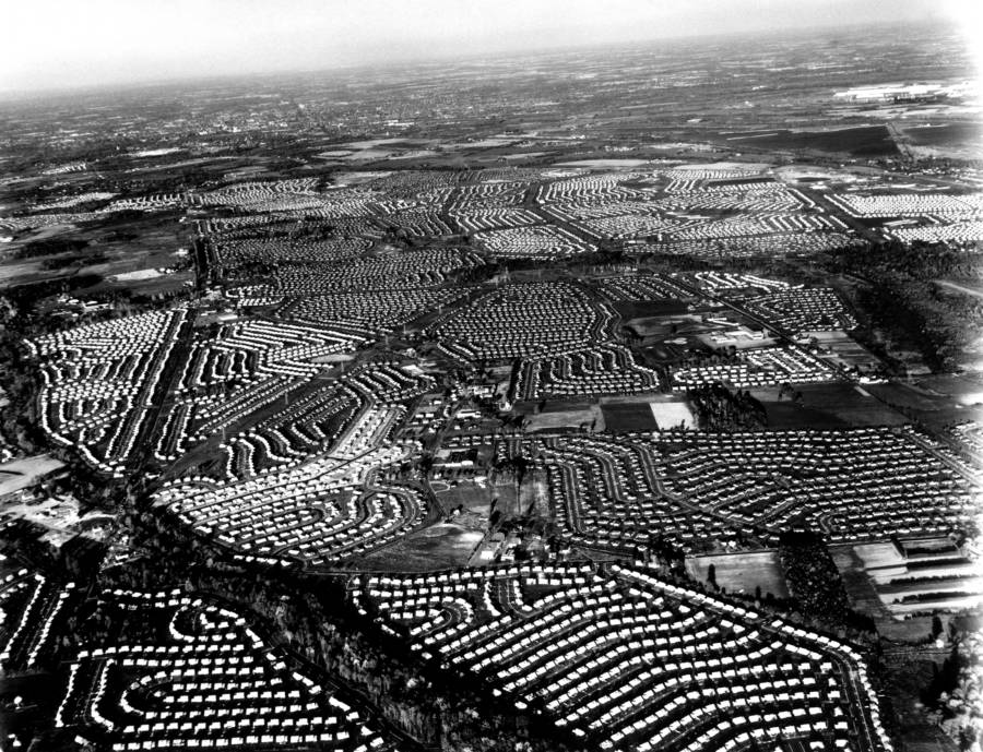
Aerial photographs of housing developments, some of the very first of their kind, in Levittown, Pa. 1957.Margaret Bourke-White/The LIFE Picture Collection/Getty Images
21 of 34
Aerial view of Manhattan from New York Harbor, with the then-new World Trade Center's Twin Towers looming above Wall Street buildings. Circa 1970.Henry Groskinsky/The LIFE Picture Collection/Getty Images
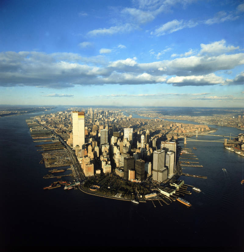
22 of 34
Aerial view from Upper New York Bay, looking north over Battery Park and the lower Manhattan skyline. 1923.FPG/Getty Images
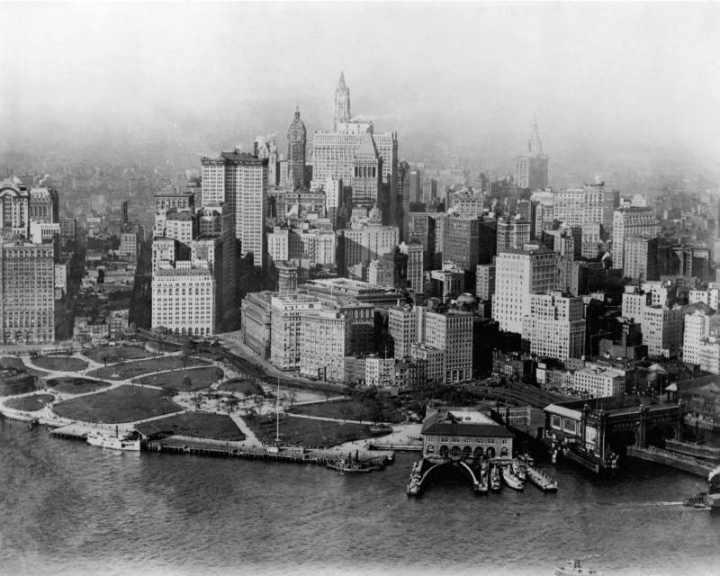
23 of 34
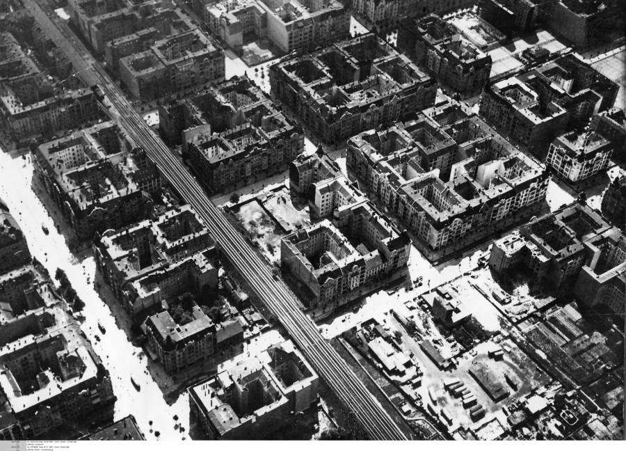
Apartment buildings in Berlin. Circa 1900.ullstein bild/Getty Images
24 of 34
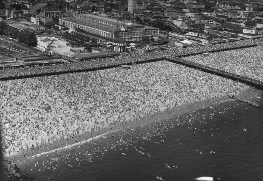
Crowds enjoy the boardwalk and beach at New York's Coney Island on a hot 4th of July. 1946.Sam Shere/The LIFE Picture Collection/Getty Images
25 of 34
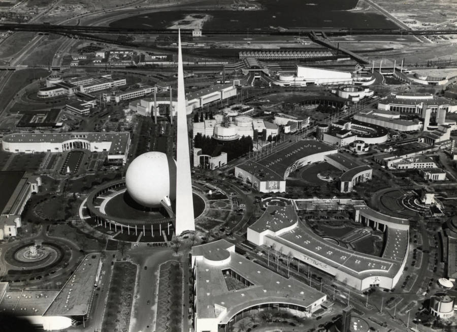
View of the 1939 New York World's Fair.The Metropolitan Museum of Art
26 of 34
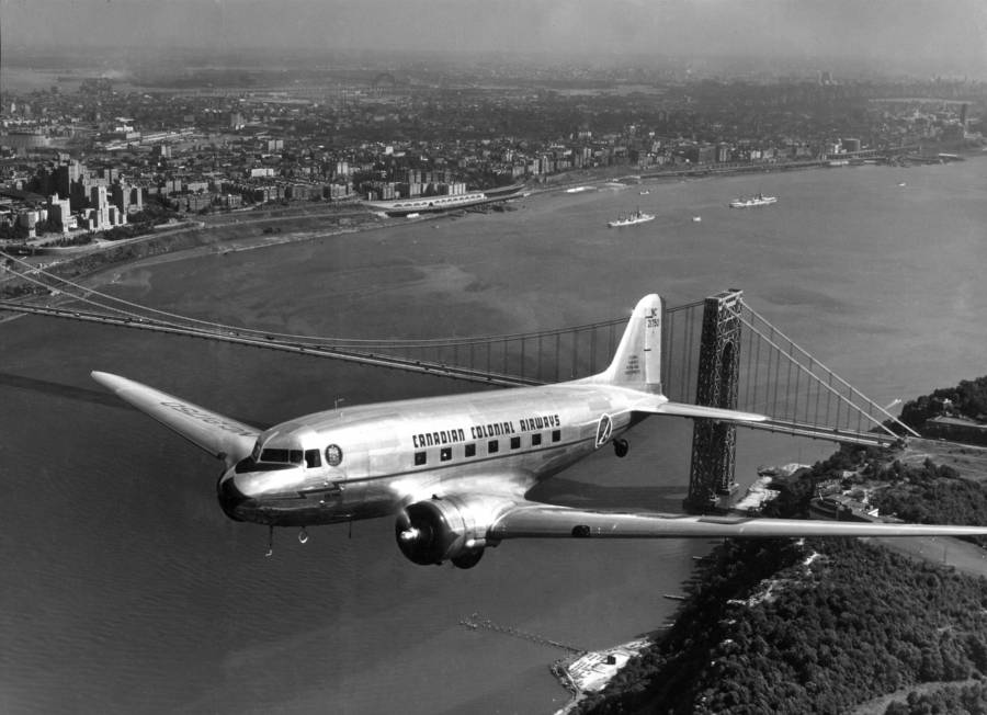
A Canadian plane flies over New York's George Washington Bridge as it makes its way up the Hudson River en route to Montreal, Canada. 1939.Photo by Margaret Bourke-White/The LIFE Picture Collection/Getty Images
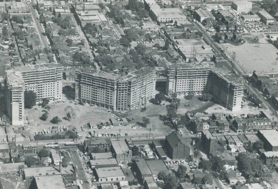
27 of 34
An aerial view of Toronto, Canada. 1967. Norman James/Toronto Star via Getty Images
28 of 34
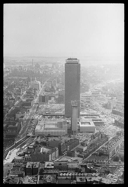
A view of the Prudential building in Boston, Mass. Circa 1964.Library of Congress
29 of 34
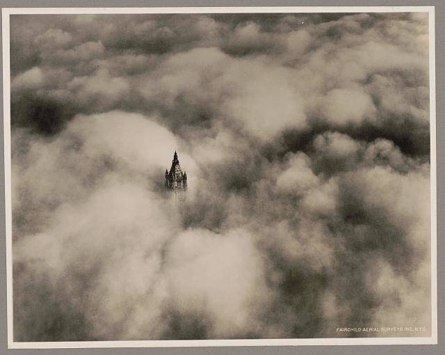
New York's Woolworth tower pokes through the clouds. 1928.Library of Congress
30 of 34
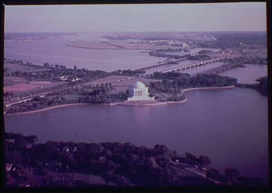
The Jefferson Memorial in Washington, D.C., just two years after its completion in 1943. Library of Congress
31 of 34
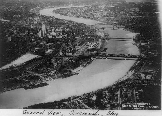
View of Cincinnati, Ohio. Circa 1934.Library of Congress
32 of 34
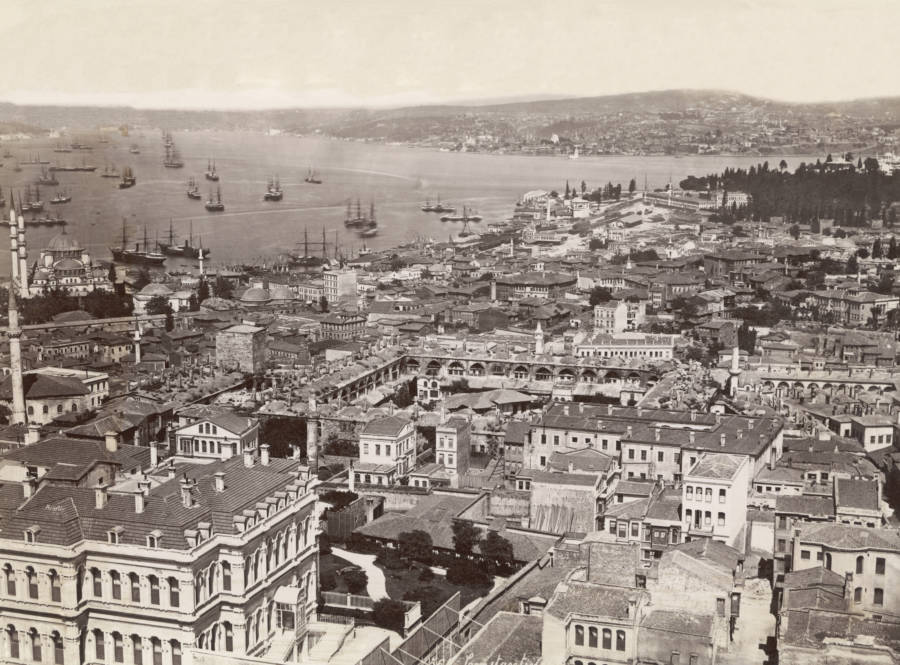
Overview of the city and harbor of Constantinople. Date unspecified.Bettmann/Getty Images
33 of 34
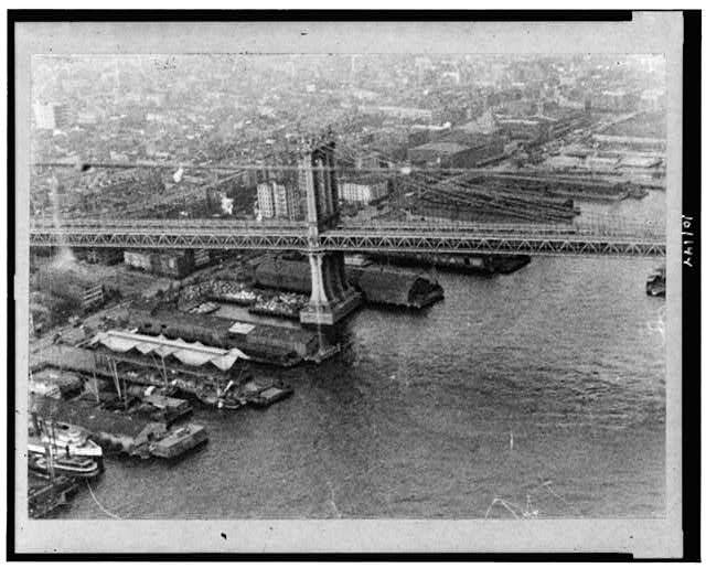
An aerial view of the Brooklyn Bridge. Circa 1912.Library of Congress
34 of 34
Like this gallery?
Share it: